When Hurricanes start appearing in the Caribbean I try to keep a weather eye on them. Just so I'm not surprised should they decide to head up the East Coast of the United States and into my area. Hurricane Irma looks like it will not be a threat to BIANKA. But, it is a serious storm for those in it's path. One of my go to sites on the Internet to get a handle on what's going on with these storms is Tropical Tidbits. Levi Cowan does an excellent job of independent analysis to show what is going on and what may happen with Hurricanes along with serious caveats so people don't get to complacent. Here is the latest update:
Showing posts with label Noaa. Show all posts
Showing posts with label Noaa. Show all posts
Wednesday, September 06, 2017


Thursday, January 21, 2016
SOMETIMES YOU GET LUCKY
The word from NOAA:
"...BLIZZARD WATCH IN EFFECT FROM SATURDAY MORNING THROUGH SUNDAY
AFTERNOON...

THE NATIONAL WEATHER SERVICE IN UPTON HAS ISSUED A BLIZZARD
WATCH...WHICH IS IN EFFECT FROM SATURDAY MORNING THROUGH SUNDAY
AFTERNOON.

* LOCATIONS...THE FIVE BOROUGHS OF NEW YORK CITY...COASTAL
  PORTIONS OF NORTHEAST NEW JERSEY...AND LONG ISLAND.

* HAZARD TYPES...HEAVY SNOW ALONG WITH STRONG AND POTENTIALLY
  DAMAGING WINDS.

* ACCUMULATIONS...SNOW ACCUMULATION OF 8 TO 12 INCHES.

* WINDS...NORTHEAST 25 TO 35 MPH WITH GUSTS UP TO 50 MPH.

* TEMPERATURES...IN THE LOWER 30S.

* VISIBILITIES...ONE QUARTER MILE OR LESS AT TIMES.

* TIMING...SATURDAY MORNING THROUGH SUNDAY AFTERNOON."
Meanwhile down here in the Caribbean it looks like this:

Feel lucky to be down here cruising for a bit as a blizzard approaches up northbut, still thinking about BIANKA on the hard.
Wednesday, September 30, 2015
HURRICANE JOAQUIN
BLOG UPDATE 10/2/15 10:46 PM
On board and waiting for the winds to stop. Thankful that Joaquin looks like it will be heading out to sea and not hitting this area. The current Gale warnings are exciting enough. Clocked a 30 knot gust on the mooring today. Winds have been relentless since yesterday afternoon:
"..STRONG WINDS AND ROUGH SEAS INTO THIS WEEKEND...
ANZ335-031000-
/O.CON.KOKX.GL.W.0022.000000T0000Z-151004T2200Z/
LONG ISLAND SOUND WEST OF NEW HAVEN CT/PORT JEFFERSON NY-
339 PM EDT FRI OCT 2 2015

...GALE WARNING REMAINS IN EFFECT UNTIL 6 PM EDT SUNDAY...

* WINDS AND WAVES...NORTHEAST 15 TO 25 KT WITH GUSTS UP TO 40 KT.
  WAVES 3 TO 5 FT.

PRECAUTIONARY/PREPAREDNESS ACTIONS...

A GALE WARNING MEANS SUSTAINED WINDS OR FREQUENT GUSTS OF 34 TO
47 KT ARE EXPECTED OR OCCURRING. OPERATING A VESSEL IN GALE
CONDITIONS REQUIRES EXPERIENCE AND PROPERLY EQUIPPED VESSELS. IT
IS HIGHLY RECOMMENDED THAT MARINERS WITHOUT THE PROPER EXPERIENCE
SEEK SAFE HARBOR PRIOR TO THE ONSET OF GALE CONDITIONS."
BLOG UPDATE 10/1/15 12:14PM
Just got this email from the Town:
"Dear Mooring Holder,
The National Weather Service is forecasting heavy rains, high winds and coastal flooding over the next several days, with the possibility of Tropical Storm Joaquin making landfall in the area early next week.
Because of this, we strongly recommend that all boat owners take necessary precautions to secure their vessels or remove them from the harbor in advance of this severe weather."

This is not shaping up to be fun weekend on the waters here on the Isle of Long. Hurricane Joaquin may be making it's way up the coast. But, before it even may even arrive we will have gale conditions on Friday into Saturday and coastal flood warnings are already in effect. Time to prepare and hope BIANKA's luck holds out through another storm.
BLOG UPDATE 10/1/15 :

I went down to the boatyard to see went to the boat yard to see what the scuttlebutt was about the weather and Hurricane Joaquin. Though the persistent northeasterly winds have kept piling up the water in Long Island Sound. So much so that coastal flooding is already occurring. I had to make a detour to reach my destination because of the flooding. This even before Hurricane Joaquin influences the area.
Saturday, August 22, 2015
KEEPING A WEATHER EYE

I'm keeping a weather eye on Hurricane Danny which looks like it will be breaking bad for a lot of sailors in the Caribbean area the next couple of days. Even though it is far from my local waters at this point. I found out such storms can sneak up on you if your guard is down. A number of years ago my gal and I were vacationing at Montauk on the eastern end of Long Island. We took a ferry over to Block Island and listened to a Park Ranger describe her family's experience during the Hurricane of 1938. We wondered why she was going on about it so much. We soon found out that indeed a Hurricane was heading for our area in the next day or two. Being on vacation we had been in a media blackout. It was the days before smart phones and wifi. We got back on the last ferry to Montauk and hightailed out of our motel room a day early. My girlfriend got on the last Long Island Railroad train heading to New York on the mainline before a tree across the tracks and shut it down. Since that time I now know to keep a weather eye on storms brewing in the Caribbean well in advance of their movements north.
Monday, December 16, 2013
SOMETHING NEW IN NEW YORK HARBOR: CHART 12334
Tweet
NOAA has just announced that a new edition of Nautical Chart 12334 which covers New York Harbor. This latest edition includes new depth measurements and shoreline depictions. Since it covers changes that occurred since super storm Sandy devastated the area it's probably a good idea to update as soon as possible. I had cruised through the area just a few days before that storm hit and have not been back since. So I will definitely be updating my chart before heading there again. It's always important to try and keep charts up to date. Here's an example. This is look at the special anchorage 20A around Ellis Island in New York Harbor from the chart 12334 edition 37:

Here is the same anchorage area from the new updated 12334 72nd edition chart:

There are changes in depth and more obstructions charted in the post Sandy chart. Also good to know is how the anchorage has changed over the years. Including the addition of a security zone around Ellis and Liberty Island which has been in effect since after 9/11 terrorist attack. Not being aware of it is sure to invite a visit from the Coast Guard, National Park Service or New York Marine Police. So you definitely want to avoid entering or anchoring inside that area. You can download a free PDF file of the chart here and also as free raster navigational chart here. Print on demand charts are available at your local chart supplier.
NOAA has just announced that a new edition of Nautical Chart 12334 which covers New York Harbor. This latest edition includes new depth measurements and shoreline depictions. Since it covers changes that occurred since super storm Sandy devastated the area it's probably a good idea to update as soon as possible. I had cruised through the area just a few days before that storm hit and have not been back since. So I will definitely be updating my chart before heading there again. It's always important to try and keep charts up to date. Here's an example. This is look at the special anchorage 20A around Ellis Island in New York Harbor from the chart 12334 edition 37:


There are changes in depth and more obstructions charted in the post Sandy chart. Also good to know is how the anchorage has changed over the years. Including the addition of a security zone around Ellis and Liberty Island which has been in effect since after 9/11 terrorist attack. Not being aware of it is sure to invite a visit from the Coast Guard, National Park Service or New York Marine Police. So you definitely want to avoid entering or anchoring inside that area. You can download a free PDF file of the chart here and also as free raster navigational chart here. Print on demand charts are available at your local chart supplier.
Wednesday, May 08, 2013
NEW YORK HARBOR SURVEY UPDATE
I mentioned a few posts back that NOAA and the Army Corp of Engineers where doing post superstorm Sandy surveys of New York Harbor. Making sure the channels were clear of debris and shoals. I hoped that they would also do surveys of the areas around the Statue of Liberty and Ellis Island. I and other sailors often use these areas for anchorage as we wait for a favorable currents to help speed us up the Hudson (North) River. I am glad to report that is the case NOAA has recently released a graphic of some recently completed surveys of those areas made in April:

As you can see the survey includes the whole area around the Statue of Liberty and Ellis Island and also the basin where the the Liberty Landing Marina is located. These new surveys should lead to some new chart data and comfort that there are not any new surprises waiting below the surface in these areas for smaller cruising sailboats following Hurricane Sandy.

As you can see the survey includes the whole area around the Statue of Liberty and Ellis Island and also the basin where the the Liberty Landing Marina is located. These new surveys should lead to some new chart data and comfort that there are not any new surprises waiting below the surface in these areas for smaller cruising sailboats following Hurricane Sandy.
Saturday, April 27, 2013
SURVEYING AFTER SANDY

It seems the Army Corp of Engineers and NOAA have been busy the past few months re doing surveys of the major commercial waterways and channels of the New York and New Jersey waters. I hope they will also survey the basin behind the Statue of Liberty and also the area north of Ellis Island. These areas are used as anchorages for smaller boats waiting for favorable currents going up and down the Hudson (North) River. BIANKA and I used the Ellis Island anchorage a few days before Sandy raked the area last year. It would be real good if they were to be surveyed and cleared of debris post Sandy before sailors start using them again during the upcoming season.
Thursday, April 11, 2013
BUH BYE SANDY!
"Sandy has been retired from the official list of Atlantic Basin tropical cyclone names by the World Meteorological Organization’s hurricane committee because of the extreme impacts it caused from Jamaica and Cuba to the Mid-Atlantic United States in October 2012. "- NOAA
No complaints from me. Even though I was one of the lucky ones. The day after Sandy hit I found BIANKA over a thousand feet away from where I last saw her the morning before. She was still attached to the mooring just not where I left her. Here is some video I took of Long Island Sound in the morning before Sandy hit. Already Long Island Sound waters had covered the beach and were starting to crash onto the parking lot:
Here is a short video of me just barely making it off the spit area as the rising waters covered the roadway leading away from the harbor:
Wednesday, November 07, 2012
HERE WE GO AGAIN!

Just when things were getting back to normal. On Monday the lights at the marina where BIANKA was tied up came on. Same for the houses in the hills surrounding the harbor. BIANKA was going to be pulled for the winter so it was my last night on board. But, I will be taking the Honda 2000 generator with me. I'm so glad I did not opt for an inboard marine generator when I converted to electric propulsion. I can move the Honda to where I need it. Because as I leave the boat for the winter NOAA is predicting another Nor'easter to hit the area today. It won't be as bad as Sandy but, coastal flood and high wind warnings have been issued. Though today I take comfort that BIANKA is now safely on land for the coming months and I don't have to worry about her as much with the coming Nor'easter as I did last week when Sandy approached.
Friday, August 10, 2012
OH NOAA!

I'm hoping that 2012 will not make it a hurricane "hat trick" for BIANKA. I was on board for Hurricane Earl in Three Mile Harbor East Hampton in 2010. Last year it was and even more ferocious Hurricane Irene that made a direct hit on BIANKA's home waters while I could only watch and worry from two hundred and fifty miles away. In both cases I prepped the boat as much as I could and hoped for the best. Happily, in both situations there was a good out come. But, I had time to do those preparations because I had been keeping a weather eye on hurricane activity thousands of miles away. It's what any prudent mariner would do as we approach peak hurricane season.
Tuesday, July 03, 2012
SURVEY SAYS
While getting BIANKA ready this spring I noticed a ship hanging out off the coast:

It's the NOAA coast survey ship Thomas Jefferson and it is conducting surveys of the nearby waters that BIANKA sails in. Which is good to see. Updated charts are always a good thing in my opinion. Looks like I'll be getting some new chart chips for my Chartplotter , paper charts and downloads in the near future once they are released by NOAA:
It's the NOAA coast survey ship Thomas Jefferson and it is conducting surveys of the nearby waters that BIANKA sails in. Which is good to see. Updated charts are always a good thing in my opinion. Looks like I'll be getting some new chart chips for my Chartplotter
, paper charts and downloads in the near future once they are released by NOAA:Monday, June 04, 2012
HURRICANE SEASON 2012

We interrupt the Bahamas Exumas blog posts to remind you that the 2012 Atlantic Hurricane season has begun. The people in the Bahamas are reminded of this with every letter they send as the Bahamas stamp above shows. BIANKA has survived through two recent brushes with Hurricanes. Earl in 2010 and last year with Irene. Experiences I hope not to repeat. Irene was particularly disturbing because unfortunately I had to be 250 miles away on a work assignment and was not able to check on the boat during or after the storm. The best that I could do was prepare the boat and then hope for the best. Hurricane preparation for your boat especially when it comes to chafe protection of the lines that hold it should be a top priority as this video shows what kinds of conditions boats on moorings and anchor might go through:
Best to have a plan in place before a Hurricane threatens.
Sunday, August 28, 2011
PURPLE RAIN
Looking at the 50 knot wind speed probabilities this morning showing the Isle of Long with a 100% chance of having 50 knot winds is not pleasant to see but, of course not unexpected.

I have the Prince song Purple Rain playing in my head at the moment. I'm not a big Prince fan and I can't really express how I feel about Irene at this point. I've been on in BIANKA sailing in gale conditions and she did well by me. What I don't know is how she will do attached to a mooring in those same conditions. It is going to be a long day.
BLOG UPDATE 9:00 AM : Checking on some buoys in Long Island Sound looks like the winds have mostly been a steady 30 knots with gusts to 45 or so. Looks like tides are about 4.5 feet over prediction. Not good but, not terrible either. I hope those numbers go down from here as the storm comes ashore. Things seem to be going in the right direction though. My optimism is rising.
BLOG UPDATE 12:46 PM Checking the buoys shows the winds at Execution Rocks out of the north and only gusting to 35 knots. While further east the buoys are still gusting to 50 knots and out of the south. So it looks like Irene is moving on. My cell phone has not rang and that's good news too. Though I'll probably have to wait until tomorrow morning to find out how BIANKA fared before I start doing the happy dance.
.

I have the Prince song Purple Rain
playing in my head at the moment. I'm not a big Prince fan and I can't really express how I feel about Irene at this point. I've been on in BIANKA sailing in gale conditions and she did well by me. What I don't know is how she will do attached to a mooring in those same conditions. It is going to be a long day.BLOG UPDATE 9:00 AM : Checking on some buoys in Long Island Sound looks like the winds have mostly been a steady 30 knots with gusts to 45 or so. Looks like tides are about 4.5 feet over prediction. Not good but, not terrible either. I hope those numbers go down from here as the storm comes ashore. Things seem to be going in the right direction though. My optimism is rising.
BLOG UPDATE 12:46 PM Checking the buoys shows the winds at Execution Rocks out of the north and only gusting to 35 knots. While further east the buoys are still gusting to 50 knots and out of the south. So it looks like Irene is moving on. My cell phone has not rang and that's good news too. Though I'll probably have to wait until tomorrow morning to find out how BIANKA fared before I start doing the happy dance.
.
Wednesday, August 24, 2011
WELL, THIS KIND OF SUCKS!
This is one of those times when I hope the NOAA people get it wrong. Expecting tropical storm conditions on the Isle of Long for the weekend. I guess the good news is they are not calling for Hurricane conditions. At least not yet.


Wednesday, June 01, 2011
HURRICANE SEASON 2011

"Across the entire Atlantic Basin for the six-month season, which begins June 1, NOAA is predicting the following ranges this year:Having been on board last year and rode out a brush with Hurricane Earl successfully I am not eager to repeat the experience. I will certainly be keeping a weather eye to make sure I am not surprised if one should one be making it's way up the coast.
•12 to 18 named storms (winds of 39 mph or higher), of which:
•6 to 10 could become hurricanes (winds of 74 mph or higher), including:
•3 to 6 major hurricanes (Category 3, 4 or 5; winds of 111 mph or higher)
Each of these ranges has a 70 percent likelihood, and indicate that activity will exceed the seasonal average of 11 named storms, six hurricanes and two major hurricanes."
Wednesday, April 13, 2011
CAPT. MIKE ON CHINCOTEAGUE ISLAND
It's been a while since Capt. Mike has smelled the salt air. So when the first mate suggested we take a little early spring three day trip out to Chincoteague Island in Virginia it seemed like a excellent idea. It's sure been a cold, cold winter up here on the Isle of Long. But, a nice weather window opened up recently so we jumped at it.


Looking down one is reminded of the local cash crop in the surrounding waters and can make one hunger for a nice bowl or Oyster or Clam chowder to counter any chill in the air:


I never did get the story on this misplaced can from the Island of Long. Perhaps it was obtained by those here on Chinoteague to do research on the compettion a long time ago.

The old swing bridge from the 1940's that ran into the center of Main Street is being torn down now that a new causeway and bridge opened last fall.


Of course one can not visit Chincoteague Island without getting a little misty eyed now and then thinking about Misty of Chincoteague . Who is gone now.


in Virginia it seemed like a excellent idea. It's sure been a cold, cold winter up here on the Isle of Long. But, a nice weather window opened up recently so we jumped at it. Just before we drove the new over water causeway we crossed Wallops Island . A fairly big NASA facility where they actually do from time to time launch rockets:
"In 1889, Wallops Island was bought and converted into a vacation destination for a handful of wealthy families from Pennsylvania, who, in turn, sold the island to the federal government in the 1940s. Once in the hands of NASA the island was transformed into a center for the high-tech development of rockets, missiles, and the means for space travel. From weather balloons and Tiamat missiles to aerodynamics and hurricane research, the Wallops Island Flight Facility and its predecessors have been instrumental in the evolution and success of the American space program."
But, what interested Capt. Mike is that there is also a NOAA facility here that keeps track of and recieves data/images from the weather satellites that we sailors now access via the Internet. So the satellite images I see on my computer screen first come through this facility here on Wallops Island. Who knew?
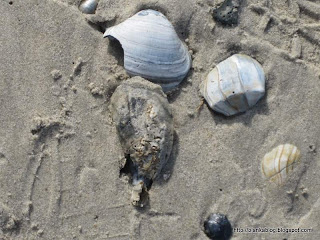
After checking into the hotel on Chincoteague it was a quick ten minute ride to Assateague Island  and a walk on the beach which is part of the National Park system
 . While I doubt if I would try to come here during the height of the summer. During these early spring days we had the beach to ourselves:
and a walk on the beach which is part of the National Park system. While I doubt if I would try to come here during the height of the summer. During these early spring days we had the beach to ourselves:
Looking down one is reminded of the local cash crop in the surrounding waters and can make one hunger for a nice bowl or Oyster or Clam chowder to counter any chill in the air:

Those signs are everywhere:


I never did get the story on this misplaced can from the Island of Long. Perhaps it was obtained by those here on Chinoteague to do research on the compettion a long time ago.

The old swing bridge from the 1940's that ran into the center of Main Street is being torn down now that a new causeway and bridge opened last fall.

It will make it easier for the local fishing fleet to come and go as they will no longer have deal with the swing bridge and will also not hold up hundreds of beach goers in cars when they do. Looks like a win win situation.


Of course one can not visit Chincoteague Island without getting a little misty eyed now and then thinking about Misty of Chincoteague
. Who is gone now.
But, some of her relations are alive and well over on Assteague Island:

While it felt good to be near the sea once again after the long cold winter. Capt. Mike is looking forward to being on the water and not just near it as soon as possible.
Sunday, April 10, 2011
Working the weather with Wxworks

Capt. Brucato is a Tugmaster who is based out of New York. He spends a lot of his time pushing or pulling barges and other BIG stuff on the waters from Maine to Florida. Since he is professional mariner when he speaks I tend to listen. He seems pretty happy with a new addition in the wheel house. It is a service using the XM satellite network called WXWORKS. While the the $30 to $50 monthly fee is a little pricey to justify for my mostly coastal cruising needs. If I were heading further off shore I might consider it. In the mean time I'm looking forward to using the free weather site put together by Allen Edwards at L-36.com during the upcoming season as an alternative.
Saturday, March 26, 2011
JUST THINKING ABOUT THE WEATHER
As Bob Dylan said so well:  "You don't need a weatherman to know which way the wind blows." Lately I became a little more suspect about what I hear from NOAA on the VHF and it's forecasts having been surprised one two many times in my travels. Since they digitized the voice of the forecasters one can never really tell who is making the forecast if anyone. I use to know the trusted forecasters by their voice. Not anymore. The digital Mr. NOAA aka Perfect Paul sounds the same all the time. Reading the forecasts online does not help much either especially when you read more and more things like "because the computer models diverge forecast is tricky" seems like they are relying more on the computers than knowledge and experience. So I use the NOAA forecast like we used the paper routines/scripts when I worked in live television. Somewhere on the page were these words of warning "This is merely a guide" Meaning things can change. So I have more and more started to become my own weather forecaster. Thanks to the Internet we sailors who can connect to it can now get a lot of the same data the NOAA folks do. I've been using the NOAA site to collect some data but, a fellow named Allen Edwards has put together a really great free weather site at L-36.com for sailors that has all the weather info you could want in just a few clicks. Watch his video demo and then try it:
One page and you've got the wind speeds, forecasts, weather maps and radar and what I find most important nearby buoy data. Plus you can edit it to your needs too. Allen has done a great job of compiling all the info a sailor might need at L-36.com and so he gets a Capt. Mike tip of the hat!
"You don't need a weatherman to know which way the wind blows." Lately I became a little more suspect about what I hear from NOAA on the VHF and it's forecasts having been surprised one two many times in my travels. Since they digitized the voice of the forecasters one can never really tell who is making the forecast if anyone. I use to know the trusted forecasters by their voice. Not anymore. The digital Mr. NOAA aka Perfect Paul sounds the same all the time. Reading the forecasts online does not help much either especially when you read more and more things like "because the computer models diverge forecast is tricky" seems like they are relying more on the computers than knowledge and experience. So I use the NOAA forecast like we used the paper routines/scripts when I worked in live television. Somewhere on the page were these words of warning "This is merely a guide" Meaning things can change. So I have more and more started to become my own weather forecaster. Thanks to the Internet we sailors who can connect to it can now get a lot of the same data the NOAA folks do. I've been using the NOAA site to collect some data but, a fellow named Allen Edwards has put together a really great free weather site at L-36.com for sailors that has all the weather info you could want in just a few clicks. Watch his video demo and then try it:One page and you've got the wind speeds, forecasts, weather maps and radar and what I find most important nearby buoy data. Plus you can edit it to your needs too. Allen has done a great job of compiling all the info a sailor might need at L-36.com and so he gets a Capt. Mike tip of the hat!
Friday, December 31, 2010
LOOKING BACK THIS NEW YEARS EVE,
"Should auld acquaintance be forgot,and never brought to mind?" So asked Robert Burns. Perhaps, but, NOAA has a great video looking back at the past years Hurricane season. It's kind of neat to see what the weather was like visually from June through November:
I was particularly interested in the September 2nd through September 4th time frame when Hurricane EARL was heading up the coast. As that was when I was getting Bianka ready for the approaching storm. Here is a screen shot of of where BIANKA was on September 2, 2010:

Then here is another shot the next day which has Capt. Mike and BIANKA somewhere in that white swirling mess of a cloud:

Riding out Earl and the ill fated attempt to join the Reid Stowe welcoming flotilla where two the "exciting" points of the season. Though somewhat in a negative direction. Still, it turned out ok. The rest of the year was just excellent. I hope 2011 turns out to be just as good or even better. With the new year to look forward to let me say:
HAPPY NEW YEAR TO ALL THE SAILORS OUT THERE!
Wednesday, September 01, 2010
EARL: AIN'T THAT PRETTY AT ALL
Well it's offical:
"FOR MARINE INTERESTS...A TROPICAL STORM WATCH IS IN EFFECT FOR
ALL OF LONG ISLAND AND CONNECTICUT COASTAL WATERS AND NEW YORK HARBOR."
and it looks like my location has entered the 50/50 range for Tropical Storm winds. But, at least it's not the Hurricane watch that's been issued for Woods Hole and other areas in New England. But, BIANKA and I are on the edge. Friday does not look like a fun day. Here's the latest Tropical Storm Force Wind Speed graphic from the NOAA Hurricane Center:
 Nice colors eh? But, to quote the late Warren Zevon:
"FOR MARINE INTERESTS...A TROPICAL STORM WATCH IS IN EFFECT FOR
ALL OF LONG ISLAND AND CONNECTICUT COASTAL WATERS AND NEW YORK HARBOR."
and it looks like my location has entered the 50/50 range for Tropical Storm winds. But, at least it's not the Hurricane watch that's been issued for Woods Hole and other areas in New England. But, BIANKA and I are on the edge. Friday does not look like a fun day. Here's the latest Tropical Storm Force Wind Speed graphic from the NOAA Hurricane Center:

"IT AIN'T THAT PRETTY AT ALL"
Subscribe to:
Posts (Atom)


 Posts


